The Quarries Beneath Paris: Catacombs, Ground Collapse, and the Engineering of a City
Beneath Paris, centuries of limestone and gypsum quarrying left a patchwork of underground chambers; a small part became the Catacombs when overflowing cemeteries forced the city to move the remains of roughly six million people. Those voids can cause serious local collapses, but Paris is not slowly sinking into one vast cavern: engineers map and reinforce an uneven underground legacy.
By MyAudioBooks.ai ·
Listen free: The Quarries Beneath Paris: Catacombs, Ground Collapse, and the Engineering of a City
Beneath the bustling streets and grand boulevards of Paris lies an enormous, fragmented world of abandoned subterranean quarries, and within one small section of that void rest the commingled remains of roughly six million people. For centuries, the French capital expanded directly across the ground it had hollowed out for building stone, eventually choosing to pack its dead into the very chambers that once supplied its foundations. That collision of extraction and burial gave rise to a persistent urban legend: the idea that Paris is slowly, inexorably sinking into a vast, single basement hollowed out beneath its feet. The real story is far more complex, driven by prehistoric geology, municipal desperation, and specialized civil engineering. In the minutes ahead, we will examine how these subterranean passages formed, why millions of bodies were carried underground, and what the geological record actually reveals about the ground beneath the capital.
At My Audio Books dot A I, you can create your own audiobooks from prompts, turn your documents into audio, all with one subscription, and store your items in your own personal library.
The physical origin of underground Paris began tens of millions of years ago across the Paris Basin, a vast geological bowl stretching across more than one hundred forty thousand square kilometers of northern France. Over successive geological eras, warm seas, lagoons, and river systems deposited alternating layers of sediment. Deep at the base lay dense marine chalk, overlaid in time by clays, sands, gypsum, and thick beds of coarse limestone known geologically as calcaire grossier. When early builders sought materials to construct fortifications, palaces, and townhouses, this coarse limestone proved ideal because it was strong enough to support heavy masonry yet soft enough to shape with hand tools.
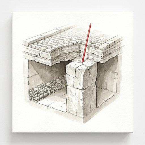
Extraction started as open-pit mining on the city margins, but as surface deposits grew scarce and urban expansion covered the ground, quarry workers followed the stone beds deep underground. They excavated by room-and-pillar mining, carving out wide extraction chambers and leaving massive blocks of intact stone to support the ceiling. North and northeast of the river Seine, particularly around the hills of Montmartre and Belleville, miners pursued thick layers of gypsum, which was crushed and heated to produce the fine white plaster of Paris used across European architecture.
Over several centuries, this extraction left a massive subterranean footprint. Within the modern administrative limits of Paris alone, former limestone workings underlie approximately seven hundred seventy hectares, while former gypsum workings cover about sixty-five hectares. In the surrounding suburban departments, the legacy is equally vast, including roughly one thousand fourteen hectares of limestone workings in Hauts-de-Seine, five hundred sixty-five hectares in Val-de-Marne, and four hundred eighty-two hectares of gypsum workings in Seine-Saint-Denis.
These figures describe the total surface area underlain by excavations, not a single continuous tunnel. Popular imagination often pictures hundreds of miles of connected highways beneath the city, but the underground is actually a fractured mosaic. Independent private quarries, municipal inspection galleries, and public ossuary routes occupy entirely different compartments of this subsurface landscape. For centuries, property owners and miners extracted stone with little coordination, leaving behind unmapped voids beneath open fields that would later be covered by dense residential districts.
The transformation of old limestone quarries into a municipal resting place was not a romantic project, but the emergency resolution of an acute public health catastrophe. By the late eighteenth century, the central parish cemeteries of Paris were overflowing. The largest among them, the cemetery of the Holy Innocents, had operated in the heart of the city for nearly ten centuries. Generations of Parisians had been packed into common burial trenches, layered atop one another until the soil of the churchyard rose several feet above street level.
The air around the central markets became notoriously putrid, and the situation reached a breaking point in the spring of seventeen eighty. In May of that year, the cellar wall of a house bordering Holy Innocents buckled under the immense physical pressure of decomposing earth and accumulated human remains. Authorities closed the cemetery immediately, followed by the closure of other central churchyards, but the problem of what to do with centuries of accumulated remains remained unresolved.
The municipal government devised an ambitious plan: transfer the bones into the disused, dry limestone quarries at the plain of Montrouge, situated south of the city gates in the district known as the Tombe-Issoire. The initial removals began in seventeen eighty-five and continued through seventeen eighty-seven. Each night after dusk, funeral convoys accompanied by chanting priests and black-draped carts carried bones through the city streets to an opening shaft, where workers poured the remains into the deep quarry rooms. In the decades that followed, further transfers cleared parish cemeteries and church vaults across the expanding capital.
According to official estimates, roughly six million people are represented in the underground ossuary. This figure reflects an aggregate historical calculation based on centuries of parish records and cemetery closures rather than a modern count of intact skeletons. The bones arrived commingled, making individual identification impossible.
Originally, workers simply piled the remains in disorderly heaps throughout the quarry corridors. In the early nineteenth century, authorities led by Louis-Étienne Héricart de Thury turned the utilitarian bone dump into a formal monument. Stonemasons constructed neat facades out of thousands of long bones, creating architectural walls punctuated by decorative rows of skulls. The ossuary became a civic site designed for moral reflection and public memory, eventually developing into the regulated heritage institution that welcomes visitors today. Yet the controlled public Catacombs route covers only about one point five kilometers, while hundreds of hectares of surrounding quarry galleries remain pitch-black, fragile, and strictly closed to the public.
The presence of extensive subterranean voids beneath a densely populated capital inevitably raises the question of ground stability. The popular phrase claiming that Paris is sinking into its own basement suggests a slow, uniform subsidence, as if the entire metropolis were gradually lowering into a single cavern. Structural geology and geotechnical engineering reveal a very different reality.
Subterranean ground failures in the Paris Basin operate through distinct physical mechanisms depending on the mineral layer and the local engineering history. In former limestone and chalk quarries, failure is primarily structural. If the original miners extracted too much stone, left supporting pillars that were too slender, or cut rooms with excessive ceiling spans, the remaining rock carries an unsustainable mechanical load. Over decades or centuries, moisture and physical weathering weaken the stone. Microscopic fractures propagate until a pillar shears or the ceiling delaminates, triggering a chimney-like upward collapse known locally as a fontis. When a fontis reaches the surface, the result is not a gentle citywide settling, but a sudden, localized crater that can swallow pavement and foundations.
Gypsum workings introduce an entirely different hazard based on chemical dissolution. Gypsum is a hydrous calcium sulfate mineral that dissolves readily in water. Where groundwater moves through underground gypsum formations, it continuously dissolves the mineral framework, whether the layer was excavated by miners or left untouched by human hands. Underground voids in gypsum zones can enlarge naturally over time, creating sudden cavities beneath the surface without any direct industrial cause.
A third mechanism involves the compaction of loose fill material. Over the centuries, miners and builders backfilled many abandoned galleries with discarded rubble and soil to clear working paths or shore up sagging walls. Over decades, heavy surface traffic and fluctuating groundwater cause this uncompacted debris to settle and shift. Surface depressions above such backfilled galleries represent the slow compaction of loose earth rather than the sudden opening of an empty cavern. Ground stability beneath Paris is governed by local variables: the depth of the workings, the geometry of supporting pillars, the presence of groundwater, and the structural loads imposed by modern buildings.
Catastrophic ground collapses are not hypothetical possibilities in the Paris region; they are a well-documented historical reality. In the seventeen seventies, a series of dramatic collapses along the Rue d'Enfer swallowed entire houses and wagons, terrifying residents and prompting the royal government to take urgent institutional action.
The historical hazard is illustrated in a detailed technical study examining former underground chalk quarries near Clamart, in the southwestern suburbs of Paris. Between eighteen twenty-seven and nineteen ninety-one, engineers documented twenty-one major collapse events in that regional mining context, each affecting a surface area greater than five hundred square meters. These failures involved massive ground volumes, sometimes triggering secondary cave-ins and severe structural damage on the surface.
This collapse record proves that ground instability is a severe, recurring engineering hazard, but it also highlights the localized nature of the problem. Chalk, coarse limestone, gypsum, and uncompacted urban soil respond to stress in fundamentally different ways. A series of major collapses in suburban chalk workings does not mean that every street across central Paris is on the verge of disappearing into a void.
To manage this complex terrain, King Louis the sixteenth established the Inspection Générale des Carrières, or the quarry inspection service, in April of seventeen seventy-seven. The agency was tasked with charting every subterranean void, inspecting underground walls, and building heavy masonry arches and reinforcement pillars beneath public roads. Originally created to oversee the former Seine department, the inspection service was reorganized in nineteen sixty-eight to provide specialized technical oversight across Paris and the surrounding departments of Hauts-de-Seine, Seine-Saint-Denis, and Val-de-Marne.
Today, the agency maintains detailed subterranean atlases and conducts ongoing geotechnical surveys. Whenever a new building, transit line, or utility trench is planned in an affected zone, engineers consult these subterranean records. If unmapped voids or deteriorated pillars are discovered, builders are required to reinforce the underground before construction begins, often by drilling deep foundation piles through the quarry level into solid underlying strata, or by injecting specialized concrete grout to fill vacant rooms. Through systematic surveillance and civil engineering, the subterranean hazard has been transformed from an unpredictable crisis into an actively managed urban condition.
When we synthesize the geological, municipal, and structural evidence, the puzzle of subterranean Paris resolves into four linked historical chapters. First, prehistoric seas deposited rich sedimentary beds of limestone and gypsum across the Paris Basin. Second, centuries of manual extraction hollowed out an intricate, uncoordinated network of subterranean rooms and pillars to supply the building blocks of the growing city. Third, an acute public health crisis in the late eighteenth century prompted city authorities to repurpose one portion of those disused workings into a massive communal ossuary. Fourth, two and a half centuries of specialized engineering have contained the physical risks through systematic mapping, structural reinforcement, and strict construction regulations.
Today, the Paris underground holds a dual identity. In one small, reinforced corner, the Catacombs function as a solemn, regulated heritage site where the bones of six million historical Parisians rest in quiet order. Across hundreds of hectares beyond those walls lies a dark, technical landscape of disused extraction rooms, abandoned tools, and fortified inspection galleries.
Managing this terrain remains an ongoing technical challenge. Historical mining was frequently undocumented, and modern construction over several centuries has altered underground water pathways and ground pressures. An archival quarry map provides an essential starting point for engineers, but it cannot guarantee that every void beneath an older neighborhood is known.
Looking to the future, new questions confront geotechnical engineers. Extreme weather events, changing groundwater tables driven by regional climate shifts, and the heavy physical vibrations of modern transit networks introduce shifting stresses into these inherited rock formations. Monitoring these spaces requires continuous maintenance, advanced sensor tracking, and careful municipal planning across multiple administrative jurisdictions. Paris is not an ancient city hovering over a single, hollow abyss, nor is it sinking into an imaginary basement. It is a thriving, layered metropolis built directly atop the geological resources that allowed it to rise, actively managing the physical legacy of its own construction.
The underground of Paris is ultimately a working archive of geological time, commercial ambition, and municipal survival. The next time you hear that a historic city is sinking into its own foundations, look past the cinematic myth and ask the real engineering questions: which street, which layer of stone, and which subterranean void?