Pheasant Island’s Shared Sovereignty: How France and Spain Govern in Turns
Pheasant Island is often said to switch countries twice a year, but France and Spain share sovereignty over it continuously; only responsibility for administering it changes every six months. Once a neutral stage for a seventeenth-century peace treaty and royal handover, the tiny island gained its shared legal status and rotating calendar through later agreements. Its enduring arrangement shows that borders are sustained by cooperation, not just lines on a map.
By MyAudioBooks.ai ·
Listen free: Pheasant Island’s Shared Sovereignty: How France and Spain Govern in Turns
In the tidal waters of the Bidassoa River, between France and Spain, lies a quiet patch of land that is often said to change countries twice every year. Six months under the Spanish flag, then six months under the French. Yet that familiar description obscures an arrangement far more interesting than a border that simply moves back and forth. The territory is never sold, traded, or divided down the middle, and its underlying legal status does not expire at each handover. What actually shifts on the first of February and the first of August, and how did a seventeenth-century war, a royal marriage, and successive treaties produce this enduring arrangement?
At My Audio Books dot A I, you can create your own audiobooks from prompts, turn your documents into audio, all with one subscription, and store your items in your own personal library.
To understand how this territory operates, you have to look at the landscape where it formed. The Bidassoa River rises in the Pyrenean highlands and flows toward the Bay of Biscay, forming a natural boundary along the final stretch between southwest France and northern Spain. Anchored in that waterway, right where the river widens between the French commune of Hendaye and the Spanish city of Irun, sits Pheasant Island. The historic town of Hondarribia lies just downriver. In French, the site is known as Île des Faisans. In Spanish, it is Isla de los Faisanes. In Basque, the language shared across both banks of the river, the waterway is the Bidasoa. Several linguistic and cultural identities overlap across this single boundary.
The island itself has a modest physical presence. It covers approximately five thousand square meters, an area somewhat smaller than a standard soccer field. That figure is an approximation rather than a fixed legal measurement, because river currents, shifting silt, and seasonal tides continuously alter its perimeter. The island has no permanent residents, no private houses, and no commercial buildings. It is not an ordinary neighborhood park where visitors stroll freely on weekends. Its compact footprint stands in sharp contrast to the elaborate diplomatic history tied to its soil.
When popular accounts describe the island as alternating between two countries, they often leave a misleading impression. They suggest a border line that snaps across the earth every half-year, or a property divided by a fence. International law makes a clear distinction between partition, a condominium, and alternating administration.
Partition divides a territory into separate national sectors, giving each state exclusive control over its own half. A condominium, by contrast, keeps the land completely undivided, placing the same parcel under the joint sovereignty of two or more states. Alternating administration describes how the practical functions of government are carried out through time. On Pheasant Island, the joint sovereignty never lapses. Instead, France and Spain take turns exercising specific administrative responsibilities over the whole island.
Popular histories frequently label Pheasant Island as the oldest or smallest surviving condominium in the world. Yet that claim introduces a counting problem. The island's diplomatic prominence, its legal definition as an undivided territory, and the calendar that governs its modern administration arose at three distinct historical moments. The story began not with bureaucratic management, but with two exhausted monarchies searching for a neutral meeting table in the middle of a border river.
The diplomatic origins of Pheasant Island were forged during prolonged war. For decades, the kingdoms of France and Spain fought across Western Europe in a contest that overlapped with, and outlasted, the wider Thirty Years' War. Even after the Peace of Westphalia brought an end to general European hostilities in sixteen forty-eight, fighting between the French and Spanish crowns dragged on for another eleven years.
By the late sixteen fifties, both monarchies were financially exhausted and needed a durable settlement. Bringing two proud royal courts together at a shared frontier created an immediate diplomatic problem. In seventeenth-century Europe, royal prestige, status, and precedence governed every formal encounter. Neither monarch could step onto foreign soil without appearing subservient to a rival king.
The island in the Bidassoa offered a practical solution. Sitting directly in the border river between the two realms, it provided a neutral diplomatic meeting ground. Artisans constructed an elaborate wooden conference pavilion across the island, engineered with strict symmetry. Two identical entrances and two identical wings met at a central salon. This design allowed the French and Spanish delegations to enter simultaneously and negotiate face to face, without either party stepping into the other's sovereign realm.
Between August and November of sixteen fifty-nine, the two chief ministers of the continent met on the island for twenty-four separate diplomatic sessions. Representing France was Cardinal Jules Mazarin, the chief minister to the young King Louis the Fourteenth. Representing Spain was Don Luis Méndez de Haro, the principal advisor to King Philip the Fourth.
On November seventh, sixteen fifty-nine, Mazarin and Luis de Haro signed the Treaty of the Pyrenees. The agreement ended the Franco-Spanish conflict, transferred strategic border provinces such as Roussillon and parts of Artois to France, and established sections of the Pyrenean frontier that remain intact today.
To reinforce the settlement, the treaty arranged a dynastic marriage between Louis the Fourteenth and the Spanish Infanta Maria Theresa, the daughter of Philip the Fourth. In June of sixteen sixty, Pheasant Island served as the ceremonial setting where the Spanish court formally presented the princess to the French monarch. Maria Theresa renounced her rights to the Spanish throne as part of the marriage settlement, a clause tied to a substantial dowry that the Spanish crown was never able to pay.
That historic meeting often leads people to assume the island served as the wedding chapel itself. The religious ceremony actually took place days later in the nearby French town of Saint-Jean-de-Luz. Pheasant Island was the diplomatic threshold, the neutral stage where the peace was celebrated and the royal courts joined hands. A stone monument stands on the island today to commemorate that settlement. Yet that seventeenth-century peace did not create the six-month administrative calendar. That machinery required centuries of further legal development.
Understanding Pheasant Island requires distinguishing three separate stages of legal history. The common assertion that today's administrative rotation has run without interruption since sixteen fifty-nine mistakes an initial diplomatic setting for a modern operating manual.
The first stage was the peace settlement of sixteen fifty-nine. The Treaty of the Pyrenees gave the island its international fame and enduring historical association. However, the treaty was designed to resolve major territorial wars and establish mountain boundaries, leaving the precise legal status of this small river sandbar largely undefined in long-term governance terms. For nearly two centuries, the island remained a revered historical landmark, but without an articulated joint administration code.
The second stage arrived in the nineteenth century, when France and Spain undertook a comprehensive effort to clarify their remaining border disputes. Between eighteen fifty-six and eighteen sixty-eight, the two nations negotiated the Treaties of Bayonne, a series of boundary conventions that surveyed and marked the entire frontier from the Bay of Biscay to the Mediterranean. In the Treaty of Bayonne of eighteen fifty-six, the governments formally addressed the Bidassoa estuary. That treaty confirmed Pheasant Island as an undivided, jointly held condominium belonging equally to both nations. Rather than drawing a boundary line across the riverbed that would divide the land in two, the treaty established that the island was shared sovereign territory.
The third stage created the operational machinery that governs the island today. Confirming joint sovereignty in eighteen fifty-six did not resolve who would maintain the grounds, patrol the surrounding waters, or handle local administration. To establish practical procedures, the two states concluded a bilateral agreement in nineteen hundred one, which took effect in nineteen hundred two. This convention established the alternating exercise of sovereign authority, creating the six-month administrative rotation that continues to govern the island.
These three stages reveal that modern governance developed incrementally. The diplomatic memory belongs to sixteen fifty-nine, the formal condominium status to eighteen fifty-six, and the rotating calendar to the start of the twentieth century. While informal local rotation practices may well have occurred before nineteen hundred two, the binding legal machinery of the calendar is a twentieth-century creation.
The administrative schedule established at the turn of the twentieth century functions with predictable precision. The calendar divides every year into two equal six-month periods.
Spain exercises sovereign administration over Pheasant Island from February first through July thirty-first. On August first, responsibility passes to France, which manages the island through January thirty-first.
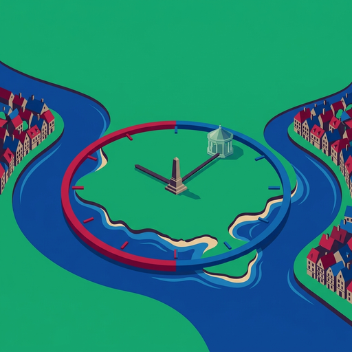
Each state holds responsibility over the whole island during its assigned six months. The land is never divided into geographic sectors. Instead of partitioning physical space, the agreement divides administrative time.
The representatives charged with this oversight are naval commanders. On the Spanish side, authority belongs to the commander of the naval station of the Bidassoa, based in Hondarribia. On the French side, governance belongs to the naval commander stationed in Hendaye, who traditionally carries the title of vice-regent of the island.
When the handover occurs on the first of February and the first of August, it does not rely on public spectacle or mass gatherings. The transition is primarily an administrative act. Naval delegates and municipal officials meet, complete the formal registration, and transfer operational duties under the standing agreement. The legal change takes place smoothly because the underlying bilateral framework remains constantly in effect.
Day-to-day stewardship connects this international treaty directly to municipal government. During Spain's administrative term, the city of Irun manages groundskeeping, cleanups, and shoreline maintenance. When France assumes responsibility, municipal crews from Hendaye take over the identical tasks. Workers tend the trees, stabilize the riverbanks against tidal erosion, and maintain the central monument that honors the peace of sixteen fifty-nine.
Sovereign responsibilities on the island involve public safety, environmental protection, policing, and defense. Historically, the naval delegates supervised riverbed fishing rights and monitored navigation along the frontier waterway. While modern European integration has largely eliminated day-to-day border inspections along the river, the underlying legal authority to maintain order remains in force.
Access to the island is strictly controlled. Pheasant Island is not open for casual tourism, camping, or afternoon picnics. To protect its river ecology and preserve a historic monument, unauthorized landings are prohibited. The public can observe the island from the riverbanks in Hendaye or Irun, or from tour boats navigating the river channel. Access to the land itself is reserved for official delegations, maintenance crews, and authorized commemorative events.
This mechanism resolves the opening puzzle. Pheasant Island does not bounce back and forth between two rival nations. The island remains undivided under a continuing bilateral framework, while administrative duties alternate like clockwork.
International history contains many failed condominiums and abandoned border treaties, yet the arrangement on Pheasant Island has persisted across generations. Its durability is best explained by four practical factors working together: manageable scale, administrative predictability, diplomatic symbolism, and legal continuity.
First, scale reduces the stakes. At roughly five thousand square meters, with no permanent residents, no taxable businesses, and no mineral wealth, the island carries no economic competition. Condominiums over populated territories often produce intense disputes over taxation, law enforcement, and political representation. On Pheasant Island, there is no competing civilian population. Its modest physical scale keeps the administrative burden small and manageable.
Second, the fixed calendar provides certainty. Handover dates on February first and August first remove administrative ambiguity. Each government knows precisely when its responsibilities begin and when they end. The naval commands and municipal teams in Hendaye and Irun work from established routines, preventing the kind of confusion that might spark diplomatic friction.
Third, the island carries significant symbolic value for both nations. It remains the physical birthplace of modern Franco-Spanish peace. Neither government has an interest in disturbing a functional compromise that commemorates an important chapter in European diplomatic history. Preserving the arrangement preserves a shared historical inheritance.
Finally, the system endures because of legal continuity. Rather than abandoning an older agreement when political conditions changed, French and Spanish officials updated the framework through successive treaties, from Bayonne in eighteen fifty-six to the convention of nineteen hundred one. Its survival is not an accident of neglect, but the result of continuous, practical legal care.
Pheasant Island is part of a Pyrenean frontier defined by historical compromises, where national borders were adapted to local realities rather than drawn as rigid abstractions.
Consider the Spanish town of Llívia, situated roughly three hundred kilometers to the east in the high Pyrenees. Llívia is a Spanish enclave surrounded entirely by French territory. Under the Treaty of the Pyrenees, Spain agreed to cede thirty-three villages in the surrounding valley to the French crown. Spanish negotiators noticed that Llívia had been chartered under Roman and medieval law as a town, not a village. Because the treaty ceded only villages, Llívia remained Spanish, creating an enclave that endures to this day.
Further west in Navarre lies Quinto Real, known in French as the Pays Quint. In this border area, the land belongs to Spain, but French farmers have exercised recognized grazing and timber rights for centuries, backed by formal cross-border agreements.
These Pyrenean examples show that national borders are rarely simple, uniform barriers. They are layered historical settlements. Pheasant Island demonstrates that shared sovereignty does not require simultaneous day-to-day administration, nor does it require physical partition. Two sovereign states can separate an enduring legal partnership from the schedule of daily responsibilities.
Several open questions remain for historians and legal scholars. The earliest local rotation practices that preceded the convention of nineteen hundred one are not fully documented in surviving records. In addition, the complete allocation of modern judicial powers on the island has rarely been tested in court. Furthermore, the physical river poses an ongoing question. The Bidassoa is a dynamic tidal waterway. Flooding, riverbed erosion, and moving sediment constantly reshape the channel. While stone reinforcements protect the riverbanks, any significant physical alteration of the island over the coming century would test how international treaties apply to a shifting landform.
The island that is often said to change countries twice a year is better understood as two nations alternating administrative responsibilities within a permanent agreement. Its diplomatic story reaches back to sixteen fifty-nine, while its practical machinery developed through later settlements. The lasting lesson of Pheasant Island is that borders are not simply lines drawn across a map. They are living institutions sustained by negotiated choices, practical compromises, and mutual consent.
If this look into shared sovereignty changes how you see international borders, consider the frontiers around you and the agreements that keep them working. There is always more history beneath the surface of the map.