Moynaq's Stranded Ships: How River Diversions Transformed the Southern Aral Sea
Moynaq’s fishing boats now stand in desert sand because Soviet irrigation diverted the rivers that sustained the Aral Sea, collapsing the fishery and stranding a town built around its port. The often-cited distance to the water shifts with the shoreline, while the exposed seabed brings dust and lasting economic and environmental harm. Recovery in the northern Aral offers hope, but Moynaq’s future depends on harder choices about shared water and life on the former lakebed.
By MyAudioBooks.ai ·
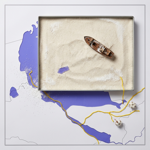
Listen free: Moynaq's Stranded Ships: How River Diversions Transformed the Southern Aral Sea
Beside the town of Moynaq in western Uzbekistan, empty fishing trawlers sit upright on open desert sand. Their iron hulls cast long shadows across dry terrain where deep water once carried regular commercial traffic. Popular accounts often describe this former harbor as sitting roughly one hundred fifty kilometers from the Aral Sea. That image presents an immediate puzzle. How does an active port become stranded in the middle of a desert, and what does that distance actually measure?
At My Audio Books dot A I, you can create your own audiobooks from prompts, turn your documents into audio, all with one subscription, and store your items in your own personal library.
Before its retreat, the Aral Sea ranked as the fourth-largest lake on Earth by surface area. Despite carrying the name of a sea, the basin is entirely inland and endorheic, meaning it has no natural river outlet to any ocean. Its surface level depended completely on a continuous hydrological balance. Inflow arrived through two primary river systems, the Amu Darya flowing from the south and the Syr Darya flowing from the east. The only major exit for that water was atmospheric evaporation under the dry Central Asian sun.
Around this inland sea, communities built durable regional economies. Moynaq developed on the southern delta of the Amu Darya, within the autonomous territory of Karakalpakstan. The town grew into a dedicated fishing port and canning center. Fleets operated out of protected anchorages, delivering catches of carp, bream, and pike-perch directly to shore-based processing facilities. Residential neighborhoods, cold-storage warehouses, ship-repair yards, and rail connections developed around that steady catch. Thousands of residents worked as boat captains, net handlers, mechanics, and processing-plant technicians, tying the community’s social identity to open water.
That balance shifted rapidly during the twentieth century. Beginning in the nineteen-sixties, Soviet central planners expanded massive irrigation networks across the desert basins of Central Asia. The primary economic objective was large-scale cotton production, alongside expanded acreage for rice and wheat. Engineers excavated thousands of kilometers of supply channels, including the Karakum Canal, to divert water out of the Amu Darya and Syr Darya before either river reached the lake.
These agricultural priorities operated across an extensive arid infrastructure. Many of the new distribution canals were unlined earthen trenches cut directly through sandy soil, allowing substantial percentages of diverted water to seep into the ground or evaporate before reaching farm fields. Large storage reservoirs held back seasonal snowmelt from the mountains, altering the natural timing of downstream river discharge.
Because an endorheic lake possesses no natural outlet to relieve or balance changes, any persistent reduction in inflow directly changes its surface area and water depth. Diverting the two feeder rivers set up a structural confrontation between an upstream agricultural economy designed to consume water and a downstream maritime settlement that could survive only if that water arrived.
When upstream withdrawals reduce river discharge below the rate of lake surface evaporation, the water balance turns negative. Across the nineteen-seventies and nineteen-eighties, the Aral Sea lost more volume each summer than it received across the entire year. As the shoreline retreated, shallow bays dried out first, exposing broad mudflats that baked into hard salt crusts.
Evaporation removes pure water while leaving dissolved minerals behind. As the lake shrank, its salinity climbed steadily. Water that had supported freshwater and brackish aquatic species gradually became as salty as the ocean, and eventually far saltier. Fish populations adapted to moderate salinity suffered reproductive failure and severe population collapses decades before the water vanished entirely.
Satellite observations document the speed of this physical retreat. Remote-sensing measurements show that the combined surface area of the remaining Aral water bodies covered approximately twenty-six thousand two hundred eighty square kilometers in the year two thousand. By two thousand ten, that surface area dropped to twelve thousand seven hundred twelve square kilometers. By two thousand twenty, satellite surveys recorded roughly nine thousand two hundred eighty-five square kilometers of open water across all surviving remnants.
Surface area captures only two dimensions of this retreat. In terms of water volume, comprehensive scientific assessments calculate that the Aral Sea system has lost roughly ninety percent of its historical volume compared to mid-twentieth-century baselines. As the water dropped, the single continuous lake fragmented into distinct geographic remnants. A northern basin separated from a larger southern system, and the southern sea eventually split into a deep western trench and a broad, shallow eastern basin.
The steepest losses occurred across the southern system adjacent to Moynaq. That geographic fragmentation grew more complex after the dissolution of the Soviet Union in nineteen ninety-one. The river systems that fed the sea suddenly crossed international borders, connecting newly independent states with competing economic needs. Upstream mountain nations prioritized winter water storage for hydroelectric power generation, while downstream agricultural nations required heavy summer releases to irrigate export crops. Coordinated basin-wide water management became vastly more difficult to sustain.
A fishing economy does not fail when the last drop of water evaporates. It fails much earlier, when environmental thresholds break the commercial chain. As salt levels in the southern Aral climbed past the tolerance levels of native commercial species, annual catches plummeted. At the same time, retreating water levels destroyed the shallow reed beds and delta wetlands where fish spawned and matured.
The physical retreat of the shoreline severed navigation. In Moynaq, harbors that once handled commercial trawlers turned into stagnant shallows and then dry mud. Boats could no longer reach their mooring docks or deliver catches directly to processing facilities. For a brief period, local authorities attempted to maintain production by dredging access channels and trucking catches from temporary anchorages farther north. In its final operating years, the Moynaq fish-canning plant even imported frozen ocean fish shipped thousands of kilometers by rail across Russia just to keep factory lines running and preserve local payrolls.
Historical records show that the Aral regional fishery once harvested tens of thousands of tons of fish each year. When that harvest ended, the economic damage radiated through the entire local population. Boat crews lost their livelihoods, but so did dock workers, net repairers, marine mechanics, freight operators, and the merchants who depended on local commerce. Families faced mounting unemployment, and younger workers began migrating away toward regional administrative centers.
The ships resting outside Moynaq today represent the physical remains of that vanished transport and fishing fleet. As navigable waters pulled away, some boats ran aground in shallow channels and were abandoned. Others were stripped for useful scrap metal or machinery.
The ship graveyard that visitors encounter today is an assembled collection rather than an undisturbed historical scene. Over several decades, surviving hulls scattered across the receding mudflats were towed, hauled, and arranged together on the former harbor floor to serve as an open-air memorial. The presence of these vessels proves that Moynaq was once a working port with an active maritime fleet. Even so, an individual hull cannot tell an observer precisely when it was decommissioned, whether it sank in place or was transported across the sand, or how far the water sits today.
The common claim that Moynaq sits roughly one hundred fifty kilometers from the Aral Sea provides a useful mental picture, but it is an approximation rather than a fixed geographic measurement. Published surveys place the town anywhere from one hundred kilometers to more than one hundred fifty kilometers from open water, depending on several technical factors.
First, the measurement changes depending on whether the starting point is the town center or the original harbor docks. Second, it depends on whether the measurement follows a direct straight line or an overland travel route through desert tracks. Most importantly, it depends on which surviving remnant of the sea is being measured, and in which season. The deep western trench remains relatively stable along the edge of the Ustyurt Plateau, roughly one hundred kilometers to the northwest. The shallow eastern basin, however, expands and contracts dramatically depending on seasonal mountain snowmelt, occasionally drying out almost entirely into an empty salt pan.
The land left behind by this retreating water is now recognized as a distinct geographic feature, the Aralkum Desert. Covering more than sixty thousand square kilometers of former seabed, it is one of the youngest deserts in the world. High continental winds frequently sweep across this flat, exposed expanse, picking up fine silt, mineral salts, and dried clay.
These dust storms carry airborne salts hundreds of kilometers beyond the historical shoreline, depositing corrosive minerals onto surrounding farmland, pastures, and settlements. Because the feeding rivers carried runoff from decades of intensive agricultural production, lakebed sediments also contain residues of fertilizers and defoliants used in regional cotton farming. The distribution of these chemical compounds varies across the former seabed, meaning that dust storms vary in chemical composition rather than presenting a uniform toxic layer everywhere.
Public health surveys in Karakalpakstan have documented elevated regional rates of chronic respiratory illnesses, kidney disease, maternal and infant health complications, and anemia. Evaluating these health burdens requires careful epidemiological context. Environmental dust exposure interacts with difficult socioeconomic factors, including access to clean drinking water, local sanitation infrastructure, nutritional variety, and regional healthcare resources. The physical transformation of the former seabed is clear, but isolating the exact contribution of specific airborne contaminants from broader public health challenges remains an ongoing scientific task.
The loss of the water body also altered the regional climate. Without the thermal buffer of a massive inland lake, summers around Moynaq have grown hotter and drier, while winters have become colder and more severe, extending the ecological consequences far beyond the dry sand.
The fate of the Aral Sea diverged along national lines during the early two thousands. In the north, Kazakhstan partnered with international financial institutions on an eighty-five-million-dollar water management project that concluded in two thousand ten. The centerpiece of this effort was the Kok-Aral Dam, a concrete dike constructed across the narrow Berg Strait to separate the northern basin from the southern depression.
By trapping the flow of the Syr Darya within the smaller northern lake, the Kok-Aral Dam raised northern water levels by several meters, reduced salinity, and allowed freshwater fish stocks to recover. Commercial fishing returned to settlements around the northern shore, such as the port of Aralsk. Official Kazakh reports indicated that the Northern Aral volume reached approximately twenty-four point one billion cubic meters in recent years, with around five billion cubic meters directed into the sea during that period.
That northern success cannot simply be duplicated around Moynaq. The southern Aral depression is far larger, deeper, and more fragmented. It depends primarily on the Amu Darya, a river that flows through multiple nations and faces immense agricultural demand along its entire path.
Instead of attempting to refill the southern lake, Uzbekistan and international agencies have focused on environmental adaptation. Forestry teams have planted millions of salt-tolerant shrubs, primarily black saxaul, directly into the exposed seabed. Saxaul roots penetrate deep into salty ground, binding loose sediment and creating low vegetative windbreaks that reduce the severity of airborne dust storms.
Planting saxaul is land reclamation and hazard mitigation, not lake restoration. The survival of these vegetative barriers depends on seedling resilience, soil salinity thresholds, local grazing pressure, and unpredictable precipitation patterns. It stabilizes the ground beneath the wind, but it does not bring back the water.
Moynaq demonstrates the challenge of infrastructure lock-in. Communities build factories, housing, paved roads, and vocational training around specific geographic resources. When the water retreated, the physical infrastructure of a maritime economy remained anchored to a location that could no longer support it.
Improving upstream irrigation efficiency does not automatically send water downstream. When canals are lined or modern irrigation techniques reduce agricultural water use, the conserved water is frequently allocated to expand farmland or support other industries. Without binding legal policies, very little of that savings reaches environmental river flows. Northern restoration and southern soil stabilization represent two distinct approaches to a shared regional crisis, each constrained by geography, political boundaries, and available river discharge.
The ships resting in the sand outside Moynaq are tangible evidence of an abrupt ecological and economic separation. They demonstrate that an inland maritime economy existed where desert now stretches to the horizon. Their present arrangement is the product of later collection rather than an undisturbed snapshot of the final day of navigation.
The drying of the Aral Sea was not an unexplainable natural catastrophe. It was the predictable consequence of an engineering strategy that prioritized agricultural output over the water balance of an endorheic lake. As regional populations expand and climate change alters mountain snowmelt patterns across Central Asia, the questions that reshaped Moynaq remain urgent. Neighboring nations must still resolve how to share transboundary rivers when water supplies grow tighter. Communities must determine what practical livelihoods can survive on land that was once a seabed. And future generations will continue to interpret the silent ships left behind on the desert floor.
If this account clarified the forces that stranded Moynaq, take a moment to look at the engineering systems that govern water where you live. You will find more deep investigations into the quiet forces shaping our global landscape by exploring our library anytime.