Japan’s Underground Flood Bypass: How It Protects Eastern Saitama and Where It Falls Short
Beneath Kasukabe, Japan’s vast “underground cathedral” is not a storm drain or a flood-proof shield for Tokyo, but a river-diversion system that carries overflowing tributaries to the Edo River. It has substantially reduced flooding in its target area, including during Typhoon Hagibis, yet its limited reach, pumping capacity, and dependence on downstream conditions make it one part of a broader flood strategy.
By MyAudioBooks.ai ·
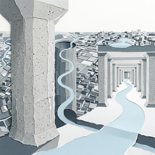
Fifty meters beneath the surface in the city of Kasukabe, fifty-nine massive concrete pillars rise into the shadows of an enormous subterranean hall. For most of the year, this vast chamber stands completely dry. It is filled only with the steady hum of ventilation shafts and the hollow acoustics of an industrial space designed for moving water rather than people.
Over the past two decades, photographs of this hall have circulated widely under striking names. Popular accounts describe it as Tokyo's underground flood cathedral, the largest storm drain on Earth, or the secret subterranean fortress that prevents the Japanese capital from flooding. Those descriptions capture the immense visual scale of the engineering, yet each label alters the underlying reality. The chamber is an industrial water regulation facility, it sits well outside Tokyo's central wards, and it does not collect municipal storm runoff from city gutters.
The Metropolitan Area Outer Underground Discharge Channel, commonly known as G-Cans, operates as an engineered river diversion bypass. Understanding how it protects millions of people requires looking past the cathedral metaphor. We have to follow the water as a storm approaches, examine the mechanical sequence that carries whole rivers underground, and weigh what public data actually reveals about the true reach of its protection.
At My Audio Books dot A I, you can create your own audiobooks from prompts, turn your documents into audio, all with one subscription, and store your items in your own personal library.
The flood challenges that produced this facility arise from the unique shape of the land north of Tokyo Bay. The Nakagawa and Ayase river basins form a low-lying, dish-shaped lowland that spans parts of eastern Saitama Prefecture and northern Tokyo. Because the surrounding topography slopes gently toward the center, natural drainage moves sluggishly toward the sea.
Throughout the second half of the twentieth century, rapid urban growth transformed this rural landscape. Paddies, wetlands, and open fields were paved over to build neighborhoods, rail corridors, and commercial districts. Asphalt and concrete sealed the ground, preventing soil from absorbing rainwater. Runoff that once trickled gradually into marshes began surging into riverbeds within minutes of a cloudburst.
Small, winding tributaries such as the Kuramatsugawa and the Otoshifurutone run through towns like Kasukabe, carrying runoff from densely settled subdivisions. During intense typhoons, these natural channels quickly run out of room. Yet widening these surface streams to handle modern flood volumes is practically impossible. Residential streets, bridges, and commercial properties stand directly against the riverbanks, meaning that widening surface channels would require displacing thousands of households and businesses.
The Japanese government addressed this geographical barrier by creating an underground bypass. Responsibility for this infrastructure falls under the national government through the Ministry of Land, Infrastructure, Transport and Tourism, alongside its Kanto Regional Development Bureau and the local Edogawa River Office. Their task was to build a system that intercepts floodwaters before they crest regional levees, routing excess water away from crowded lowlands.
To understand this system, its engineering category must be distinguished from municipal water networks. The facility is not a sanitary sewer system handling domestic wastewater. Nor is it an urban storm drain collecting street-corner runoff through curbside grates, or an underground reservoir designed to store water for long periods. It is an active flood diversion bypass that intercepts swelling rivers, carries that excess water underground across municipal boundaries, and releases it into a wider, more stable river.
The journey of water through this system begins when severe rain swells the local tributaries. Along five distinct waterways, the government constructed specialized intake weirs. When a river rises above a set threshold, the overflow spills across these weirs and enters an intake channel. This siphons off the dangerous crest of the flood while allowing normal streamflow to continue downstream.
From the intake points, the water plunges into vertical shafts. The system incorporates five primary shafts, each measuring roughly thirty-two meters across and descending approximately seventy meters into the ground. These shafts are large enough to fit an entire space shuttle standing vertically, but their dimensions serve a hydraulic purpose. As water drops seventy meters, its downward velocity creates destructive energy. The shafts employ spiral vortex drop structures, guiding the water along the perimeter walls to dissipate kinetic force and prevent pockets of air from blocking the tunnel below.
At the bottom of these shafts, water enters a deep connecting tunnel. This tunnel stretches for six point three kilometers, buried about fifty meters below ground, following the corridor beneath National Route sixteen. Measuring more than ten meters in inner diameter, the tunnel functions as an engineered underground waterway. It links the separate intake shafts, gathers water from across the basin, and conveys it toward a central outlet.
The tunnel discharges directly into the facility's most recognizable space, known technically as the pressure-adjusting water tank. This is the chamber often photographed as the underground cathedral. It measures approximately one hundred seventy-seven meters in length, seventy-eight meters in width, and eighteen meters in height. The fifty-nine concrete pillars supporting the ceiling each stand seven meters long, two meters thick, and weigh roughly five hundred metric tons.
These pillars do more than support the weight of the soil and buildings above. When water surges into the tank from the deep tunnel, it enters with violent momentum and shifting turbulence. If turbulent water were drawn directly into drainage pumps, the uneven pressures and trapped air would damage the machinery through cavitation. The pressure-adjusting tank provides the necessary volume for the water to slow down, settle, and equalize its surface before reaching the pump intakes.
At the edge of this tank sits the drainage pump station, powered by gas turbines adapted from commercial aviation engines. When running at full capacity, these turbines drive massive impellers that lift water out of the underground chamber and discharge it through sluice gates into the Edo River. The total discharge capacity of the station reaches two hundred cubic meters per second, a pumping rate that could empty a standard twenty-five-meter swimming pool in less than two seconds.
The figure of two hundred cubic meters per second represents an operating ceiling, not a constant discharge during every storm. Water can only be pumped out as fast as the Edo River can safely receive it. While the Edo River is a larger, heavily leveed channel designed to convey water out to Tokyo Bay, it possesses finite capacity. If upstream downpours cause the Edo River itself to rise near capacity, the pumps must be throttled back. Relieving floods in one tributary basin cannot come at the expense of triggering failures downriver.
Building this hydraulic circuit required a multi-decade public investment. Excavation began in nineteen ninety-two, requiring specialized deep shield tunneling machines to bore through complex soil layers saturated with pressurized groundwater. Sinking vertical shafts thirty-two meters wide through water-bearing strata demanded deep continuous diaphragm walls to prevent surrounding soil from collapsing during construction.
The project opened in stages to deliver partial protection as soon as segments were functional. In June two thousand two, the authorities activated the partial route connecting the Kuramatsugawa area. Four years later, in June two thousand six, crews completed the final link to the Otoshifurutone River, bringing the entire six point three kilometer network into service. In total, construction spanned roughly thirteen years at an official cost of approximately two hundred thirty billion yen.
This scale has led international commentators to label the installation the world's largest storm drain. Examining that superlative reveals how engineering records depend on definitions. If the comparison concerns underground storage volume, Chicago's Tunnel and Reservoir Plan encompasses miles of larger tunnels and massive surface reservoirs holding billions of gallons. If the metric is multifunctional transportation and drainage, Kuala Lumpur's SMART tunnel combines a dual-deck motorway with a flash-flood diversion conduit.
The Metropolitan Area Outer Underground Discharge Channel distinguishes itself in a specific category: it is among the world's largest dedicated subterranean flood diversion systems by pump discharge capacity and vertical shaft volume. Applying the storm-drain label obscures its functional identity. Municipal storm drains collect surface water off local roads and roofs. This facility moves river water, operating at the scale of an entire river basin.
Evaluating the effectiveness of this facility requires understanding how engineers measure avoided disaster. When public agencies state that a flood channel prevented billions of yen in damage, they are not reporting an observed cash balance. A storm can only happen once in the physical world; it cannot occur simultaneously with the diversion gates open and closed.
To calculate avoided damage, hydrologists construct counterfactual computer models. Engineers gather real-time rain gauge data, soil moisture levels, and river gauge readings from a storm. They run two simulations: one modeling what happened with the underground channel running, and a counterfactual simulation modeling how high the rivers would have crested without it. By comparing the modeled water depths across residential grids and matching those depths to property values, they estimate the damage that would have occurred without intervention.
In an official assessment of the Nakagawa and Ayase river basins, the land ministry analyzed severe typhoons to gauge the channel's impact. Under their selected baseline conditions, the facility achieved approximately a ninety percent reduction in the number of flooded homes within the target impact zone. For that specific analyzed event, the avoided damage was estimated at approximately twenty-six point four billion yen.
Public reporting in two thousand twenty-four, citing official records from the land ministry, placed the cumulative flood damage prevented by the system at more than one hundred fifty billion yen since operations began. This cumulative figure reflects dozens of distinct flood-diversion operations across more than two decades.
Interpreting that figure requires looking at the modeling assumptions behind it. Cumulative totals depend heavily on property valuations, economic adjustments applied across decades, and the models used to isolate the channel's impact. In reality, benefits are shared with local retention ponds and strengthened levees. The headline figure indicates that the infrastructure has significantly blunted urban flood losses, but it represents a modeled estimate rather than an audited financial ledger.
The operational capability of the facility faced a major test in October two thousand nineteen during Typhoon Hagibis. Hagibis brought record-breaking rainfall across central and eastern Japan, dropping over a thousand millimeters of rain in mountainous areas within forty-eight hours. Across the nation, dozens of river levees collapsed, flooding thousands of square kilometers and causing widespread loss of life.
In the lowland basin north of Tokyo, the discharge channel ran continuously at full capacity. The system diverted roughly twelve million cubic meters of floodwater away from the tributaries and lifted it into the Edo River over the course of the storm. A peer-reviewed hydrological study published in two thousand twenty-one analyzed the performance of Tokyo's underground flood infrastructure during Hagibis. The researchers found that underground discharge channels and regulating reservoirs across the capital region made significant contributions to keeping urban rivers within their embankments.
At the same time, the events of two thousand nineteen demonstrated the limits of structural engineering. While the diversion channel kept local tributaries from overflowing in Kasukabe, neighboring communities experienced devastating inundation. Some faced interior runoff that never reached an intake, while others suffered catastrophic levee failures along separate river systems. A diversion channel can perform at its mechanical peak while severe flooding overwhelms the wider metropolitan region.
The performance of the discharge channel during extreme storms highlights four clear boundaries that define its real-world operation.
The physical limits of the system begin with geographic reach. The channel does not drain metropolitan Tokyo as a whole. It intercepts floodwaters exclusively from five designated tributaries in eastern Saitama Prefecture. Storm surges from Tokyo Bay, flash floods in the western hills, or localized cloudbursts over downtown commercial wards fall entirely outside its physical reach.
A second constraint lies in hydraulic throughput. The maximum pumping rate of two hundred cubic meters per second is a rigid structural ceiling. If extraordinary storm bands generate four hundred cubic meters of tributary overflow per second, the excess volume will simply overwhelm the intake structures and spill across surface embankments.
Downstream conditions introduce a third dependency: the receiving capacity of the Edo River. The entire bypass works by transferring risk from small, vulnerable channels to a larger receiving river. If heavy upstream rain pushes the Edo River to critical flood stages, discharge operations must be restricted. The facility cannot pump water into a river that has no room left to carry it.
Finally, the infrastructure requires continuous mechanical and operational upkeep. Industrial gas turbines, high-pressure gates, and concrete chambers exposed to abrasive sediment demand constant inspection and expensive overhauls. Concrete erodes under high-velocity water, and mechanical components deteriorate over time. Keeping these subterranean systems ready for unpredictable weather requires steady public funding decades after excavation ends.
Because no single engineering project can eliminate flood risk, Japan's national water policy has shifted toward basin-wide integrated management. Rather than relying exclusively on underground tunnels, planners combine structural works with distributed storage and nature-based solutions. Permeable parks absorb local runoff, while strict zoning guides construction away from vulnerable flats. These physical measures are paired with real-time monitoring and early evacuation networks.
This integrated approach raises fundamental questions for modern cities facing climate uncertainty. When municipal budgets are finite, engineers must evaluate whether the next major investment should go toward building another capital-intensive deep tunnel, or toward decentralized, nature-based sponge infrastructure and elevated urban design. They must also assess how flood-control investments distribute safety across communities, balancing which neighborhoods are protected by levees and diversion works against those downstream that receive the diverted flow.
The underground cathedral is not a magic shield that makes a metropolis invulnerable. It is a specialized, highly capable hydraulic bypass that reliably shaves the dangerous peaks off regional floods.
When evaluating bold claims about flood-proof cities, three questions cut through the myth. Where precisely is the protection delivered? What specific type of hydraulic structure is doing the work? And what does the verified operational record reveal about its true operating limits?
If this look into the mechanics of underground flood engineering changed how you think about city infrastructure, share this essay with someone who appreciates how modern cities solve complex physical challenges.