Bab el-Mandeb Under Threat: Separating Houthi Territorial Claims From Maritime Control
Reports of Houthi advances along Yemen’s coast and onto strategic islands in September 2026, followed by a Saudi-backed counteroffensive, raise a crucial question: did the Houthis capture Bab el-Mandeb, or merely threaten it? The account finds no independently verified, lasting takeover or closure of this vital trade route, while explaining how mainland missile and drone attacks can still force costly shipping diversions around Africa. Its central lesson is that holding territory, disrupting maritime traffic, and possessing lawful authority are three very different forms of power.
By MyAudioBooks.ai ·
Listen free: Bab el-Mandeb Under Threat: Separating Houthi Territorial Claims From Maritime Control
In mid-September two thousand twenty-six, international news wires carried an alarming report. Houthi fighters in Yemen had reportedly swept down the Red Sea coast, capturing critical mainland ports and landing on islands inside Bab el-Mandeb, the narrow gateway connecting the Indian Ocean to the Mediterranean Sea. Within weeks, mid-October dispatches described a fierce counteroffensive by Saudi-backed Yemeni government forces, claiming to reclaim that vital ground. Between these rapid battlefield developments lies a critical question. Did the Houthis actually take Bab el-Mandeb, or has public perception confused the temporary presence of fighters on remote outposts with absolute control over global trade?
At My Audio Books dot A I, you can create your own audiobooks from prompts, turn your documents into audio, all with one subscription, and store your items in your own personal library.
To understand why a narrow strip of open water commands global attention, consider the surrounding geography. Bab el-Mandeb, an Arabic name translating to the Gate of Tears, forms a natural bottleneck between the southwestern coast of Yemen and the African shores of Djibouti and Eritrea. At its narrowest point, the passage spans barely twenty-nine kilometers across, creating a funnel through which a substantial portion of international commerce must navigate. Every commercial container vessel, crude oil tanker, and bulk carrier traveling between Europe and Asia through the Suez Canal must thread this specific passage.
Maritime chokepoints derive their strategic importance from the vast distances they compress. When traffic moves without interruption through Bab el-Mandeb, industrial cargo and refined fuels travel along the most direct maritime route connecting the Atlantic basin and the Indian Ocean. When transit through this passage becomes hazardous, the primary alternative requires commercial vessels to divert entirely around the southern tip of Africa. That detour around the Cape of Good Hope adds roughly three thousand five hundred nautical miles to a voyage. It demands ten to fourteen days of additional sailing time, burns hundreds of tons of extra bunker fuel, and sharply elevates marine insurance premiums.
The political forces facing each other across this shoreline reflect years of entrenched warfare. In northern Yemen, the Houthis, formally known as Ansar Allah, hold substantial territory and administer major urban populations, receiving financial and technical backing from Iran. Opposing them stands the internationally recognized government of Yemen, supported by a coalition led by Saudi Arabia. Beginning in late two thousand twenty-three, the Houthis expanded their military operations into regional waters, launching unmanned aerial drones and anti-ship missiles at commercial vessels to impose economic leverage during broader regional conflicts.
Evaluating claims regarding this waterway requires separating three distinct forms of power that public reporting frequently blurs together. First is territorial possession, which means stationing personnel on a specific piece of mainland coastline or an offshore island. Second is maritime coercion, which involves the practical capability to disrupt or threaten shipping through direct strikes or credible hazards. Third is sovereignty, the legally recognized authority to govern and regulate transit under international law. An armed group can possess one of these capabilities without possessing the others, and distinguishing between them explains what actually took place along the coast.
The narrative of a sudden Houthi takeover gained traction in mid-September two thousand twenty-six. Multiple international dispatches described a rapid advance by Houthi units pushing southward along Yemen's western maritime corridor. According to these accounts, fighters first entered the historic Red Sea port town of Mokha, advanced through the coastal district of Dhubab, and moved into the shoreline village of Murad.
Mokha holds substantial operational value for any military force operating along the coast. As an established port city, it provides access to paved coastal highways, staging areas for vehicular logistics, and sheltered anchorages suitable for small, fast watercraft. By advancing past Mokha and Dhubab, Houthi units positioned themselves along the immediate coastal approaches overlooking the strait. From those mainland positions, the reported offensive expanded onto offshore islands scattered across the southern Red Sea and directly within the navigation channels.
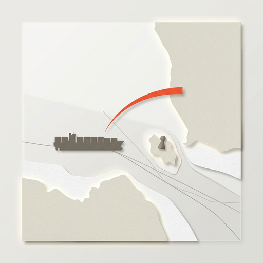
The most prominent claim focused on Mayyun Island, historically known as Perim. Mayyun sits within the narrowest section of Bab el-Mandeb, physically dividing the international passage into two distinct maritime corridors. To the east lies the Small Strait, a shallow channel roughly three kilometers wide running near the Yemeni coast. To the west lies the Large Strait, a deep-water shipping channel roughly twenty-five kilometers wide where the vast majority of deep-draft commercial vessels and supertankers transit.
Holding Mayyun provides an elevated vantage point in the center of the waterway. From this single landmass, an armed force gains unobstructed visual observation of approaching vessels, positions for coastal-defense surveillance radars, and staging points for small interception boats. North of Mayyun, reports described additional Houthi deployments on Zuqar Island and the Greater and Lesser Hanish archipelago, located roughly one hundred sixty kilometers north of Bab el-Mandeb. These volcanic islands occupy prominent positions in the southern approaches to the Red Sea.
A crucial detail emerges from the initial reports describing these island advances. In each case, Houthi fighters arrived following the sudden withdrawal of hundreds of government-aligned troops, rather than after coordinated amphibious battles. Moving into positions vacated by an opponent demonstrates an opportunistic advance. Yet it leaves open whether the occupying force possesses the logistical endurance, fortified defenses, or air protection required to hold those positions against an organized counterattack.
Examining the evidence behind the September reports reveals significant limits in the public record. Initial news accounts appeared across international and regional organizations, including Ahram Online, Euronews, regional television networks rebroadcasting wire material, and an analytical bulletin published by the Maryland Coordination and Analysis Center.
These publications attributed their reporting to local Yemeni administrative officials, anonymous military contacts, official Houthi announcements, and local eyewitnesses. When several media organizations publish similar accounts within hours of each other, they frequently rely on the same shared wire dispatches or single-source regional briefings rather than independent, on-the-ground investigations.
In the days following those initial reports, commentary across public discussion expanded the claims. Local movements into unfortified coastal villages and offshore islands were presented as proof that the Houthis had established complete control over the entire western coast and effectively closed Bab el-Mandeb. Such expansive conclusions require robust, independent verification that the available evidence does not provide.
As of mid-October two thousand twenty-six, no neutral international monitoring mission, United Nations observer mission, or independent satellite imagery provider has published verified maps documenting sustained Houthi military installations on those islands. The public record contains no proof that Houthi forces deployed coastal radar stations, surface-to-air missile batteries, or hardened drone launch facilities on Mayyun or the Hanish islands. It remains unverified whether small reconnaissance teams simply walked through abandoned buildings.
Maintaining a functional military outpost on a remote volcanic island introduces severe logistical difficulties. Every liter of drinking water, gallon of generator fuel, replacement component, and crate of ammunition must arrive across open water. Without naval protection or air cover, isolated detachments on exposed islands remain vulnerable to maritime interdiction and aerial strikes, demonstrating the vast distance between walking onto an island and establishing an enduring maritime fortress.
The ability to threaten commercial traffic in Bab el-Mandeb has never depended on physically occupying the islands inside the strait. Long before the September reports, Houthi forces conducted an extensive campaign against commercial vessels using long-range weaponry stationed deep inside mainland Yemen. An official advisory issued by the United States Maritime Administration recorded more than one hundred attacks on merchant ships between November two thousand twenty-three and October two thousand twenty-five. Those incidents involved commercial vessels associated with more than sixty nations.
An advisory update released on October second, two thousand twenty-six, confirmed that the southern Red Sea remained a hazardous environment for merchant shipping. Crucially, that official assessment defined the waterway as a persistent threat zone subject to missile and drone attacks, rather than a channel occupied, closed, or governed by an opposing navy.
On July twentieth, two thousand twenty-six, the Houthis declared an official blockade on Saudi-affiliated shipping navigating Bab el-Mandeb, following reported cross-border strikes near Sana'a and into Saudi territory. While Houthi leadership described this policy as a blockade, official records demonstrate the vast difference between declaring a policy and enforcing it on the water. The record contains no evidence showing that Houthi forces maintained naval patrols capable of intercepting, inspecting, or turning back every designated commercial vessel attempting passage through the corridor.
The operational range of the Houthi arsenal was demonstrated on August twenty-fourth, two thousand twenty-six, when the motor tankers Amzan and Daisy were reportedly struck by missiles off the port of Yanbu. Yanbu lies along the Saudi coastline, hundreds of kilometers north of Bab el-Mandeb. That incident demonstrated that mobile, land-based missile systems located on the mainland can project force across vast distances in the Red Sea without requiring stationary garrisons on Mayyun or Zuqar. Mainland launchers offer concealment and mobility, whereas fixed island positions present vulnerable, stationary targets for opposing air power.
The fluid nature of the ground contest became undeniable on October twelfth, two thousand twenty-six, when NBC News reported a major counteroffensive launched by Saudi-backed Yemeni government forces. Updated reports on October fourteenth indicated that government-aligned units retook critical areas around Bab el-Mandeb. This counteroffensive demonstrated that the September advances were contested rather than consolidated, upending the narrative that the Houthis had achieved permanent or exclusive control over the strait.
Evaluating the verified evidence from September through October fourteenth, two thousand twenty-six, brings us back to our three central questions: who holds the physical ground, who can interrupt passage, and who possesses lawful authority?
Examining physical possession reveals an active, unstable combat zone. The record confirms rapid Houthi movements into specific coastal towns and southern islands following government troop withdrawals in mid-September, followed shortly by an organized government counteroffensive that contested or reversed those gains. Control over locations such as Mokha and Mayyun Island remains fluid, characterized by active fighting rather than consolidated, long-term administration.
Examining coercive capability confirms that maritime disruption operates independently of complete territorial control. Commercial shipping lines and maritime insurance syndicates do not need a strait to be physically occupied to alter their operations; they respond to the statistical probability of physical attack. When ballistic missiles and attack drones threaten shipping lanes, insurance underwriters raise war-risk premiums to prohibitive levels, prompting fleet managers to route vessels around Africa. The Houthis continue to project credible coercive power from mobile launchers on the mainland, regardless of whether their personnel occupy offshore islands.
Examining legal authority clarifies the principles established by international law. Under the United Nations Convention on the Law of the Sea, international straits used for navigation are governed by the regime of transit passage, which guarantees the right of continuous transit for commercial shipping. Territorial advances by an armed movement do not confer recognized sovereignty or the legal right to restrict international navigation. Even a sovereign coastal state operates under strict international constraints if it attempts to close or restrict an international strait to foreign vessels.
The verifiable record as of October fourteenth, two thousand twenty-six, supports a clear conclusion. The Houthis possess a proven capability to threaten commercial shipping and temporarily advanced ground forces into sensitive coastal positions. However, they have not established permanent possession of the surrounding islands, nor have they seized, closed, or conquered the Strait of Bab el-Mandeb.
Whenever future developments claim that an international maritime chokepoint has fallen, apply the three tests examined today: verify who physically holds the ground, determine who can credibly disrupt passage, and check who holds lawful authority under international law. If this analytical framework provided clarity on the realities of maritime power, keep these three questions in mind as you evaluate the changing events across global trade routes.